- Downloaded
- 49.8 GB
- Uploaded
- 1.6 TB
- Ratio
- 32.01
- Seedbonus
- 512,706
- Upload Count
- 36 (40)
Member for 1 years
Blue Marble Geographics Global Mapper® pro
Spatial data processing, analysis, and visualization
The all-in-one GIS software
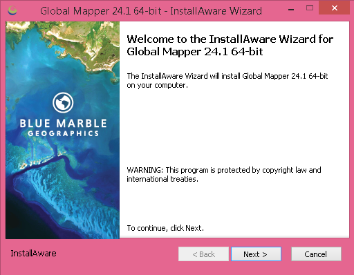
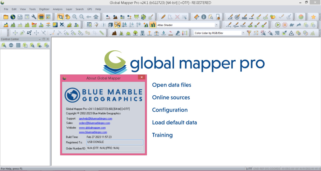
Program version: 24.1.0 (Feb 27, 2023)

Global Mapper Pro® is a comprehensive and easy to use GIS application that provides an extensive collection of tools for data creation, editing, advanced 2D and 3D analysis, scripting methods for workflow automation, and expansive file format support. Incorporating all of the point cloud processing functionality previously available in the now-retired Lidar Module, Global Mapper Pro provides users with numerous new and enhanced data processing and analysis tools. The following features are available in Global Mapper Pro only.

Drone-data Processing with Pixels to Points
The creation of 3D point cloud and mesh data from a drone or UAV-collected images is made easy with the Pixels to Points tool in Global Mapper Pro. With the addition of the Pixels-to-Points Wizard, users are able to choose from a variety of project types to refine process settings based on the desired output. Using the structure from motion process with opportunities to add ground control points for positional accuracy, this tool generates a 3D point cloud, orthoimage, and mesh from a set of drone-collected images.
Lidar Data Editing
Including manual and automatic classification methods, Global Mapper Pro offers the opportunity to fully classify 3D point cloud data. Automatic ground, building, tree, powerline, and pole classification and feature extraction tools work with lidar or photogrammetrically-generated point cloud data.
With various selection methods available in 2D, 3D, and the Path Profile views, point return classes, elevation, and attributes can be altered. The Swath Separation tool easily creates swath images, allowing users to explore the vertical separation between overlapping lidar swaths. Additional tools to enhance the 3D position of point clouds through manual rectification or based on control points or overlapping point clouds provide a set of tools suited for all lidar data processing.
Point Cloud Segmentation by Spectral Graph Partitioning
This tool divides the point cloud into clusters of points based on similarity across attributes and spatial properties. Users are able to choose which attributes to consider when breaking the data set into segments and specify the importance of these values. The result of the segmentation analysis is a point cloud with a unique ID assigned to each identified segment in the point cloud. The points can then be colored by the assigned segment ID values in order to clearly show the results of the analysis. The flexibility and customization in this tool, combined with a selection method to select and edit individual segments, greatly improves manual classification, to achieve custom point cloud classification in a semi-automated process.
Automatic Breakline Creation
This tool is able to find distinct changes in the slope or curvature of the terrain, and extract these edges as 3D vector breaklines. Depending on the goals of the analysis, there are three breakline detection methods available in this tool:
1.) Find Breaklines at Slope Region Boundaries is best suited for extracting breaklines around flat areas like a hydro-flattened water feature or a plateau.
2.) Find Breakline Around Edges of Regions with Similar Slopes bases the analysis on a user-defined curvature threshold, creating breakline features around areas within the defined maximum curvature value, such as a river bank.
3.) Find Breaklines at Any Surface Break looks at a curvature analysis to identify breaklines at extreme points of curvature in the data set. This method is useful for generating lines along ridges and valleys.
Terrain Painting
Using the surface of a terrain model, the Terrain Painting tool provides a convenient way to alter, enhance, or add features to the landscape. The Terrain Paint menu allows users to fill gaps, smooth terrain, raise and lower terrain, and much more.
Script Builder and Script Editor
The Script Builder tool transforms actions taken in the program user interface into Global Mapper Script commands with an easy-to-use record button.
For manual script creation, editing and execution, the interactive Script Editor allows users to open multiple scripts in a tabbed interface and save them individually. With easy undo and redo options, syntax coloring, and command suggestion, the Script Editor greatly improves how scripts are interacted with in the Global Mapper interface.
python Programming Language Integration
Based on Python v3.9, Global Mapper users are now able to automate workflows in the program using the Python programming language. Not replacing Global Mapper Script, but adding to the scripting language options, Python scripts can be written in the new Script Editor or outside of Global Mapper, and run within the Global Mapper interface, via the command line, or in a Python environment.
Kriging
The powerful Variography and Kriging analysis tool improves data prediction in Global Mapper Pro. Fully customize the data sampling and variogram plot and determine what theoretical model fits best for the generation of a kriged prediction layer.
Global Mapper Mobile Integration
Pairing with Global Mapper Pro is Global Mapper Mobile, an app available on iOS and Android for field data reference and collection. Wirelessly share data to a mobile device directly through Global Mapper desktop’s Mobile Data Management tool. Additionally, through this tool, Global Mapper Mobile Package files can be merged to combine datasets created by different field collectors.
Automatic Vectorization of Raster Data
The new Vectorize Raster tool matches pixels of similar colors or elevation values and generates areas bounding these pixels. To remove the sharp edges of the pixel-derived areas the features are then smoothed based on the user input threshold. When setting up the vectorization process, users have complete control over the series of steps executed by the tool.
Elevation Models and Contour Lines Generated from Lidar
Expanded methods for elevation grid creation in Global Mapper Pro make it easy for users to generate digital terrain model (DTM) and digital surface model (DSM) layers from 3D point cloud data. With options to specify the method of grid creation, interpolation distance, point filtering, and grid resolution users have complete control over the creation of terrain surfaces.
The Contour Generation tool is expanded to generate contour lines directly from 3D point cloud data. With advanced filtering options that can be applied to the point cloud, the contour generation tool created continuous 3D lines describing the 3D environment represented by the point cloud.
Mesh Feature Creation
Enhancing the creation of buffer features with volumetric mesh features, cylindrical, spherical, or pipe mesh features can be created from points, lines, and polygons. Mesh surfaces can also be created from point clouds using a number of different methods that allow for simplification and interpolation to create a detailed but lightweight mesh terrain surface.
Recent Developments in Global Mapper Pro
The version 24.1 release of Global Mapper Pro includes
Updates to the Segmentation based lidar classification tool
A new Pixels-to-Points Wizard allows users to choose from a variety of predefined project types to refine processing settings depending on the desired output
Updates to the Mobile Data Management tool to include a new viewer to visually inspect and compare data gathered in Global Mapper Mobile.
Enhancements to the Point Cloud Comparison tool to include evaluations for the distance between point clouds and a statistical report and visual representation of the offset between two clouds

compatible with Windows 10 and 11 (64-bit version), and Windows Server 2012/2016/2019/2022
8 GB of RAM and 600 MB of hard drive space for the installation.
Languages: Multi

Follow and read ReadMe.txt in download folder
Activation & dongle protection removed
credits: TEAM BTCR

Program version: 24.1.0 (Feb 27, 2023)
Global Mapper Pro® is a comprehensive and easy to use GIS application that provides an extensive collection of tools for data creation, editing, advanced 2D and 3D analysis, scripting methods for workflow automation, and expansive file format support. Incorporating all of the point cloud processing functionality previously available in the now-retired Lidar Module, Global Mapper Pro provides users with numerous new and enhanced data processing and analysis tools. The following features are available in Global Mapper Pro only.
Drone-data Processing with Pixels to Points
The creation of 3D point cloud and mesh data from a drone or UAV-collected images is made easy with the Pixels to Points tool in Global Mapper Pro. With the addition of the Pixels-to-Points Wizard, users are able to choose from a variety of project types to refine process settings based on the desired output. Using the structure from motion process with opportunities to add ground control points for positional accuracy, this tool generates a 3D point cloud, orthoimage, and mesh from a set of drone-collected images.
Lidar Data Editing
Including manual and automatic classification methods, Global Mapper Pro offers the opportunity to fully classify 3D point cloud data. Automatic ground, building, tree, powerline, and pole classification and feature extraction tools work with lidar or photogrammetrically-generated point cloud data.
With various selection methods available in 2D, 3D, and the Path Profile views, point return classes, elevation, and attributes can be altered. The Swath Separation tool easily creates swath images, allowing users to explore the vertical separation between overlapping lidar swaths. Additional tools to enhance the 3D position of point clouds through manual rectification or based on control points or overlapping point clouds provide a set of tools suited for all lidar data processing.
Point Cloud Segmentation by Spectral Graph Partitioning
This tool divides the point cloud into clusters of points based on similarity across attributes and spatial properties. Users are able to choose which attributes to consider when breaking the data set into segments and specify the importance of these values. The result of the segmentation analysis is a point cloud with a unique ID assigned to each identified segment in the point cloud. The points can then be colored by the assigned segment ID values in order to clearly show the results of the analysis. The flexibility and customization in this tool, combined with a selection method to select and edit individual segments, greatly improves manual classification, to achieve custom point cloud classification in a semi-automated process.
Automatic Breakline Creation
This tool is able to find distinct changes in the slope or curvature of the terrain, and extract these edges as 3D vector breaklines. Depending on the goals of the analysis, there are three breakline detection methods available in this tool:
1.) Find Breaklines at Slope Region Boundaries is best suited for extracting breaklines around flat areas like a hydro-flattened water feature or a plateau.
2.) Find Breakline Around Edges of Regions with Similar Slopes bases the analysis on a user-defined curvature threshold, creating breakline features around areas within the defined maximum curvature value, such as a river bank.
3.) Find Breaklines at Any Surface Break looks at a curvature analysis to identify breaklines at extreme points of curvature in the data set. This method is useful for generating lines along ridges and valleys.
Terrain Painting
Using the surface of a terrain model, the Terrain Painting tool provides a convenient way to alter, enhance, or add features to the landscape. The Terrain Paint menu allows users to fill gaps, smooth terrain, raise and lower terrain, and much more.
Script Builder and Script Editor
The Script Builder tool transforms actions taken in the program user interface into Global Mapper Script commands with an easy-to-use record button.
For manual script creation, editing and execution, the interactive Script Editor allows users to open multiple scripts in a tabbed interface and save them individually. With easy undo and redo options, syntax coloring, and command suggestion, the Script Editor greatly improves how scripts are interacted with in the Global Mapper interface.
python Programming Language Integration
Based on Python v3.9, Global Mapper users are now able to automate workflows in the program using the Python programming language. Not replacing Global Mapper Script, but adding to the scripting language options, Python scripts can be written in the new Script Editor or outside of Global Mapper, and run within the Global Mapper interface, via the command line, or in a Python environment.
Kriging
The powerful Variography and Kriging analysis tool improves data prediction in Global Mapper Pro. Fully customize the data sampling and variogram plot and determine what theoretical model fits best for the generation of a kriged prediction layer.
Global Mapper Mobile Integration
Pairing with Global Mapper Pro is Global Mapper Mobile, an app available on iOS and Android for field data reference and collection. Wirelessly share data to a mobile device directly through Global Mapper desktop’s Mobile Data Management tool. Additionally, through this tool, Global Mapper Mobile Package files can be merged to combine datasets created by different field collectors.
Automatic Vectorization of Raster Data
The new Vectorize Raster tool matches pixels of similar colors or elevation values and generates areas bounding these pixels. To remove the sharp edges of the pixel-derived areas the features are then smoothed based on the user input threshold. When setting up the vectorization process, users have complete control over the series of steps executed by the tool.
Elevation Models and Contour Lines Generated from Lidar
Expanded methods for elevation grid creation in Global Mapper Pro make it easy for users to generate digital terrain model (DTM) and digital surface model (DSM) layers from 3D point cloud data. With options to specify the method of grid creation, interpolation distance, point filtering, and grid resolution users have complete control over the creation of terrain surfaces.
The Contour Generation tool is expanded to generate contour lines directly from 3D point cloud data. With advanced filtering options that can be applied to the point cloud, the contour generation tool created continuous 3D lines describing the 3D environment represented by the point cloud.
Mesh Feature Creation
Enhancing the creation of buffer features with volumetric mesh features, cylindrical, spherical, or pipe mesh features can be created from points, lines, and polygons. Mesh surfaces can also be created from point clouds using a number of different methods that allow for simplification and interpolation to create a detailed but lightweight mesh terrain surface.
Recent Developments in Global Mapper Pro
The version 24.1 release of Global Mapper Pro includes
Updates to the Segmentation based lidar classification tool
A new Pixels-to-Points Wizard allows users to choose from a variety of predefined project types to refine processing settings depending on the desired output
Updates to the Mobile Data Management tool to include a new viewer to visually inspect and compare data gathered in Global Mapper Mobile.
Enhancements to the Point Cloud Comparison tool to include evaluations for the distance between point clouds and a statistical report and visual representation of the offset between two clouds
compatible with Windows 10 and 11 (64-bit version), and Windows Server 2012/2016/2019/2022
8 GB of RAM and 600 MB of hard drive space for the installation.
Languages: Multi
Follow and read ReadMe.txt in download folder
Activation & dongle protection removed
credits: TEAM BTCR
| 
|

clean 
You must be registered for see links
|