- Downloaded
- 93.5 GB
- Uploaded
- 56.5 TB
- Ratio
- 619.44
- Seedbonus
- 8,964,548
- Upload Count
- 1199 (1205)
Member for 9 years

You must be registered for see links
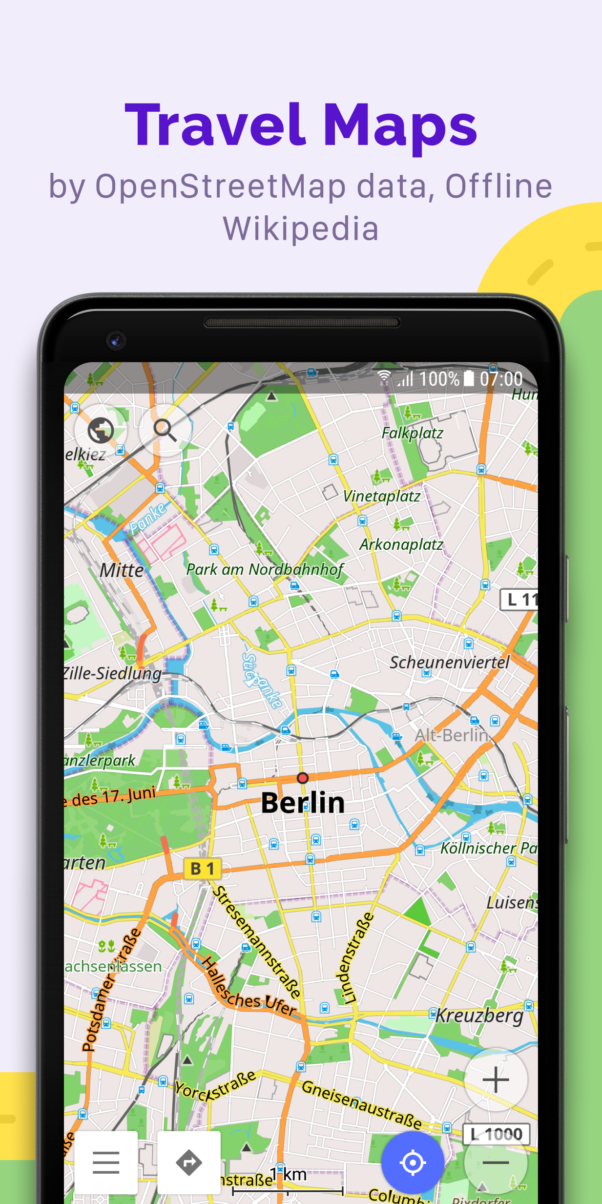
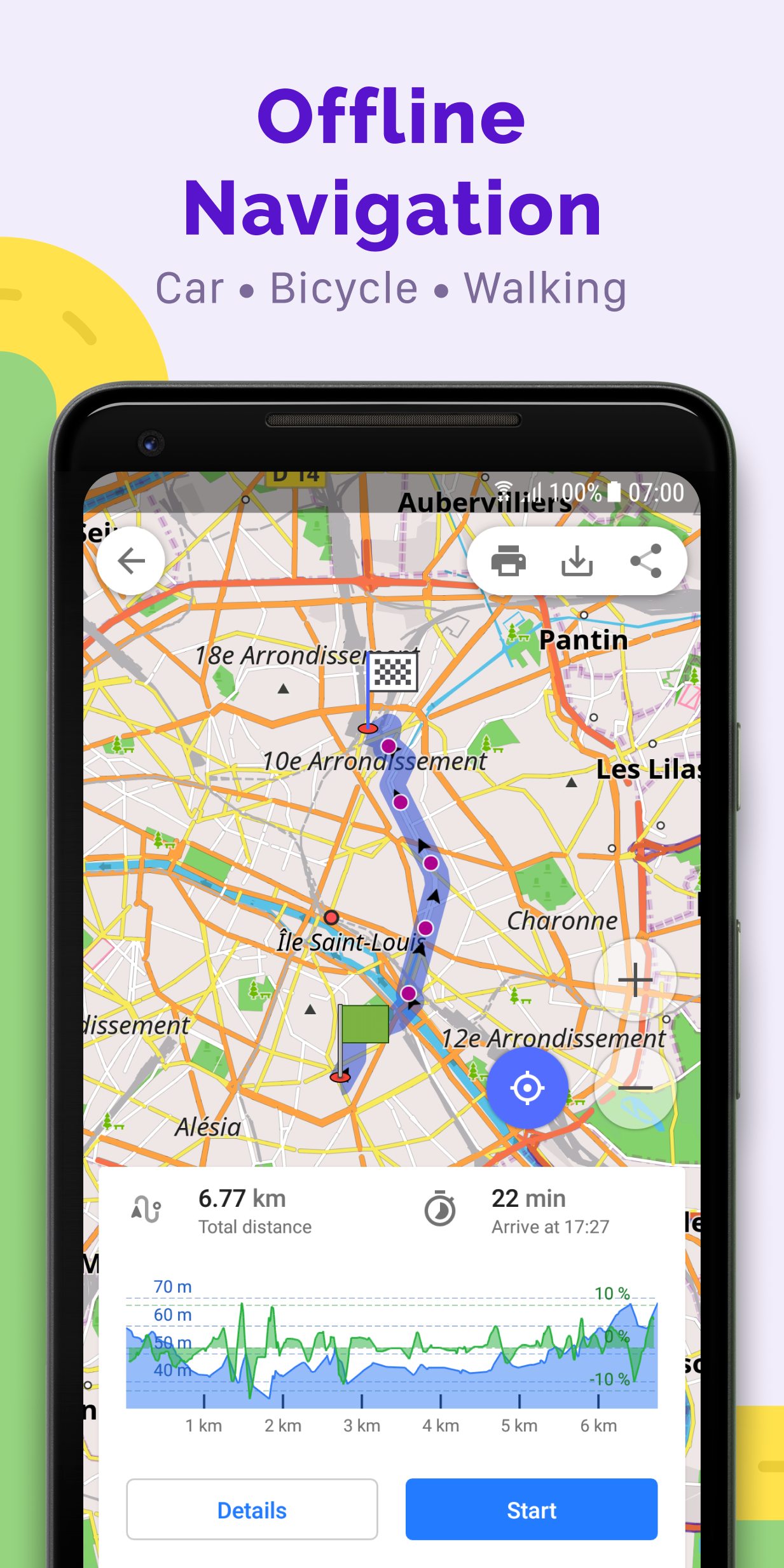
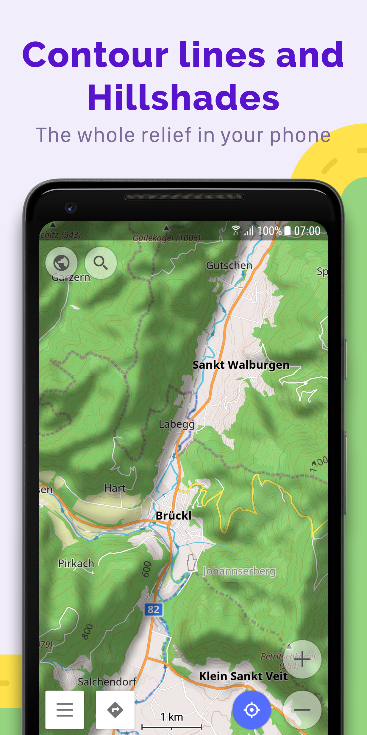
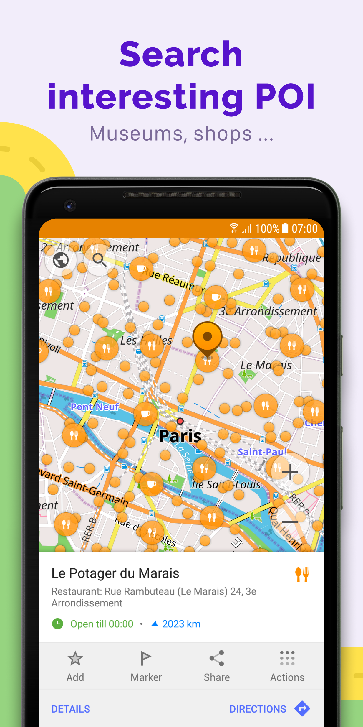
OsmAnd+ (OSM Automated Navigation Directions) is a map and navigation application with access to the free, worldwide, and high-quality OpenStreetMap (OSM) data. Enjoy voice and optical navigation, viewing POIs (points of interest), creating and managing GPX tracks, using contour lines visualization and altitude info, a choice between driving, cycling, pedestrian modes, OSM editing and much more.
Some of the main features
Navigation
• Works online (fast) or offline (no roaming charges when you are abroad)
• Turn-by-turn voice guidance (recorded and synthesized voices)
• Optional lane guidance, street name display, and estimated time of arrival
• Supports intermediate points on your itinerary
• Automatic re-routing whenever you deviate from the route
• Search for places by address, by type (e.g.: restaurant, hotel, gas station, museum), or by geographical coordinates
Map viewing
• Display your position and orientation
• Optionally align the picture according to compass or your direction of motion
• Save your most important places as Favorites
• Display POIs (point of interests) around you
• Display specialized online tiles, satellite view (from Bing), different overlays like touring/navigation GPX tracks and additional layers with customizable transparency
• Optionally display place names in English, local, or phonetic spelling
Use OSM and Wikipedia data
• High-quality information from the best collaborative projects of the world
• OSM data available per country or region
• Wikipedia POIs, great for sightseeing
• Unlimited free downloads, directly from the app
• Compact offline vector maps updated at least once a month
• Selection between complete region data and just road network (Example: All of Japan is 700 MB or 200 MB for the road network only)
Safety features
• Optional automated day/night view switching
• Optional speed limit display, with reminder if you exceed it
• Optional speed-dependent zooming
• Share your location so that your friends can find you
Bicycle and pedestrian features
• Viewing foot, hiking, and bike paths, great for outdoor activities
• Special routing and display modes for bike and pedestrian
• Optional public transport stops (bus, tram, train) including line names
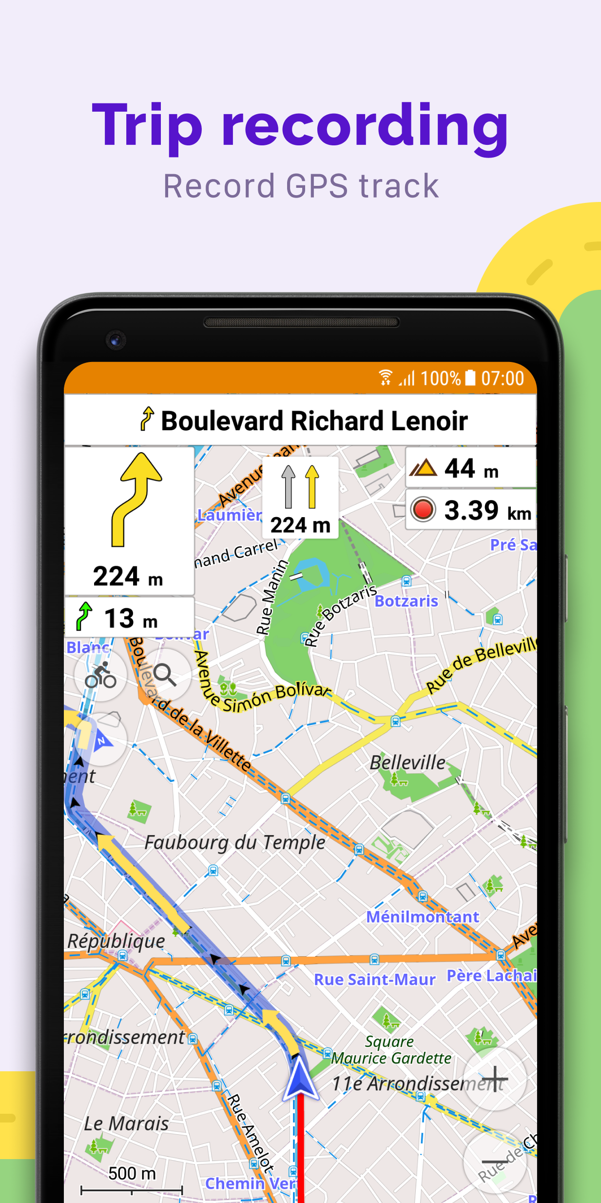
• Optional trip recording to local GPX file or online service
• Optional speed and altitude display
• Display of contour lines and hill-shading (via additional plugin)
Directly contribute to OSM
• Report data bugs
• Upload GPX tracks to OSM directly from the app
• Add POIs and directly upload them to OSM (or later if offline)
• Optional trip recording also in background mode (while device is in sleep mode)
Approximate map coverage and quality
• Western Europe
• Eastern Europe
• Russia
• North America
• South America
• Asia
• Japan & Korea
• Middle East
• Africa
• Antarctica
Most countries around the globe available as downloads! From Afghanistan to Zimbabwe, from Australia to the USA. Argentina, Brazil, Canada, France, Germany, Mexico, UK, Spain...
WHAT'S NEW
• Glide Ratio Widget
• Added ANT+ temperature widget
• Better memory management for large GPX tracks
You must be registered for see links

You must be registered for see links
Read the Read-Me Supplied
Language: Multi Language
File Size: 150 MB
Minimum Requirements:
Android 6.0+
All Credits to: 7Zipper
You must be registered for see links

-
 OsmAnd+ — Maps & GPS Offline v4.6.2.7z.torrent
- (12 KB, 95, Size: 150.2 MB, Seeders: 8, Leechers: 0, Completed: 68)
-
-
Created With:uTorrent/2210
-
Comment:Downloaded From https://www.teamos.xyz/
-
Peers:8 Seeders + 0 Leechers = 8 Peers
-
Last Announced
-
Info Hash:247553d6cb8164590fdf5a6a3bba1b4690441dfd
-
- Loading…