Sherry Jandu
Member
- Downloaded
- 36.7 GB
- Uploaded
- 660.2 GB
- Ratio
- 17.97
- Seedbonus
- 28,811
- Upload Count
- 0 (0)
Member for 9 years
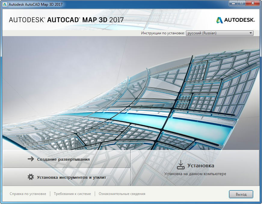
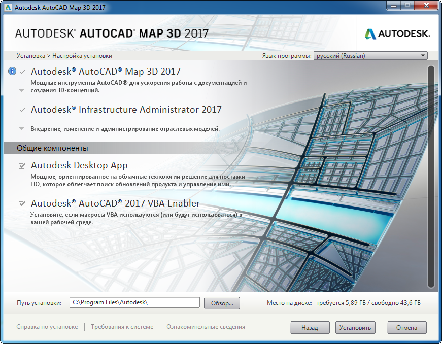
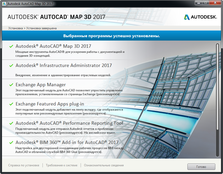
AutoCAD Map 3D, by Autodesk, is a geographic information system (GIS) solution included with the AutoCAD computer-aided design (CAD) system. The user-friendly GIS software enables users to create, manage, and analyze geographic data within a comprehensive 3D environment. Businesses of every size use AutoCAD Map 3D in industries spanning engineering, construction, scientific research, transportation, agriculture, and mining. AutoCAD Map 3D enables users to create detailed topological maps that allow them to plan future projects, refresh existing infrastructure, and more.
Autodesk Inc. is a leading developer of 3D modeling software solutions for engineering, media and entertainment, and design organizations. They have been in business since 1982 and are based in San Francisco, California.
As a reminder, AutoCAD Map 3D comes included with the AutoCAD CAD software solution, and you can visit the Autodesk website to learn more about that particular product.
The application also allows you to streamline data import processes through the ability to link to multiple GIS and CAD data sources through application programming interface (API), helping to save time by mitigating time-consuming manual data entry processes. AutoCAD is available for installation on Windows and Mac workstations; The Autodesk website has more information about the product’s system requirements.
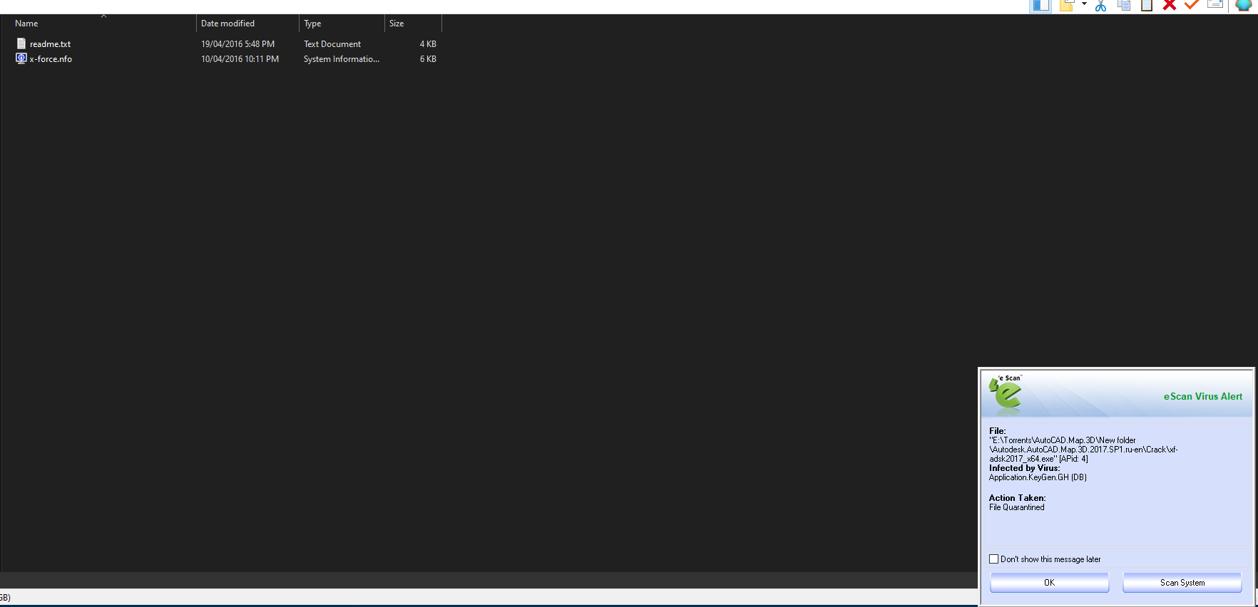
SHOWING LOCAL ANTI-VIRUS SCAN RESULTS (E-Scan)
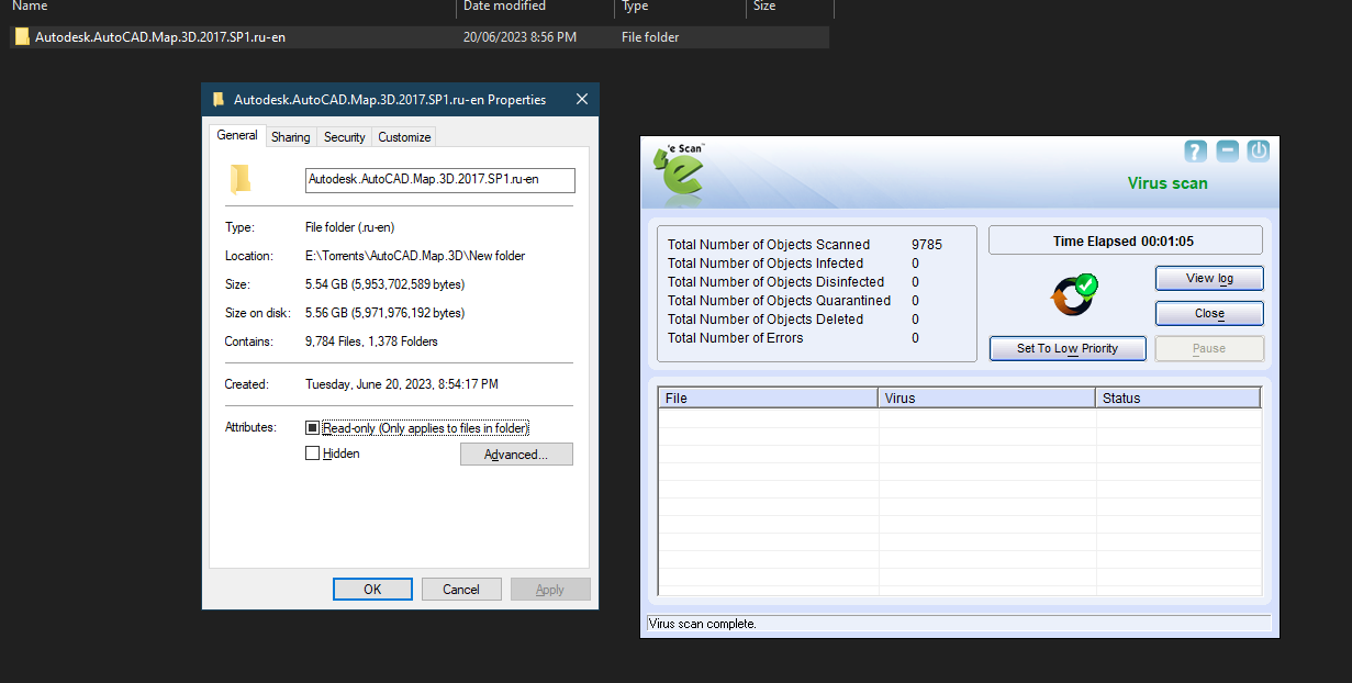
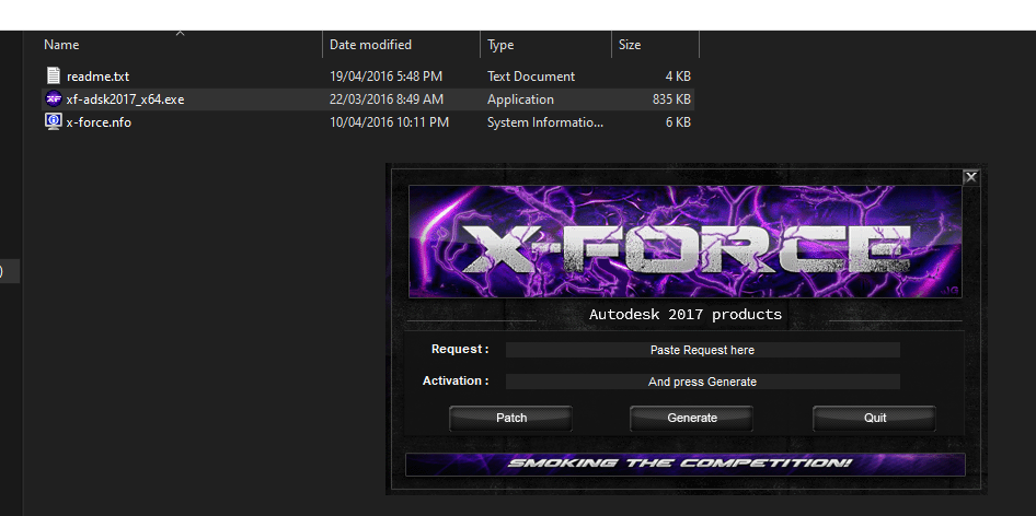
You have to temperarry disable antivirus to run this medicine.
Original Credit: m0nkrus
Autodesk Inc. is a leading developer of 3D modeling software solutions for engineering, media and entertainment, and design organizations. They have been in business since 1982 and are based in San Francisco, California.
As a reminder, AutoCAD Map 3D comes included with the AutoCAD CAD software solution, and you can visit the Autodesk website to learn more about that particular product.
What Is AutoCAD Map 3D?
AutoCAD Map 3D (part of the AutoCAD CAD system) is a robust GIS toolkit used to create detailed geographic maps, manage geospatial data, and visualize a wide range of geographic elements for intuitive analysis. The GIS product enables users to model maps with practical CAD tools, perform in-depth spatial analysis, automate drawing clean-up tasks, and more.The application also allows you to streamline data import processes through the ability to link to multiple GIS and CAD data sources through application programming interface (API), helping to save time by mitigating time-consuming manual data entry processes. AutoCAD is available for installation on Windows and Mac workstations; The Autodesk website has more information about the product’s system requirements.
You must be registered for see links
What’s Included in AutoCAD Map 3D?
AutoCAD Map 3D features end-to-end GIS support. The intuitive system allows employees to create detailed maps from topographical information imported data sources, including external GIS and CAD systems, use coordinate geometry functionality to ensure mapping accuracy, and automate drawing clean-up tasks that can save time. The system also comes with a spatial data analysis feature that explores and analyses how objects interact with their environments. AutoCAD Map 3D features a robust data analysis toolkit as well, enabling you to visually report on different types of datasets that include attributes, maps, objects, and more. More detailed information about everything included with AutoCAD Map 3D can be found on the Autodesk website.Benefits of Using AutoCAD Map 3D
One significant benefit of AutoCAD Map 3D is that it is included as part of the AutoCAD solution, one of the world's most widely used CAD software solutions. The system optimizes data management, capturing, storing, and analyzing large amounts of geographic data sets, including an easy-to-understand visual data analysis feature. AutoCAD Map 3D can also mitigate risk by identifying potential problems, obstacles, and other issues during the planning stage before they can cause expensive and time-consuming disruptions on location. Another considerable benefit of using AutoCAD Map 3D is that it supports integrated data import automation through API technology, which increases mapping data management accuracy and productivity and reduces manual data input processes so that employees can turn their attention to higher-value tasks and assignments.
SHOWING LOCAL ANTI-VIRUS SCAN RESULTS (E-Scan)
You have to temperarry disable antivirus to run this medicine.
You must be registered for see links
Original Credit: m0nkrus
Last edited:

")